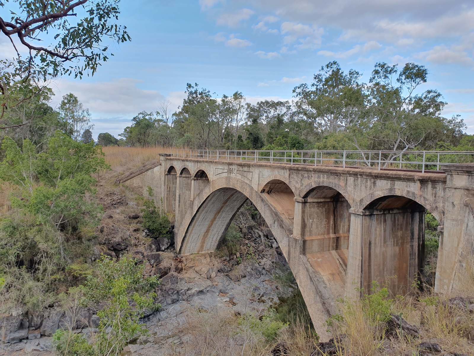

Heritage concrete arch rail bridge over a rocky creek in open eucalypt country, North Burnett, Queensland

Mount Shamrock Project  ·  North Burnett, Queensland

An underexplored copper–gold district, held in one package.

Kangal Resources holds a large tenement package in the North Burnett, surrounded by known and historic mineral systems. Early-stage work has returned high-grade gold, copper and critical-mineral rock chips over coincident geophysical targets — several of them still untested by drilling.

3Exploration permits
6Target areas
20.2 g/tBest rock-chip gold
QLDNorth Burnett

The company

A junior explorer working one district properly.

Kangal Resources Pty Ltd is a private Australian mineral exploration company. Our work is concentrated on the Mount Shamrock Project — three granted exploration permits covering a belt of historic goldfields, intrusive centres and skarn systems between Mount Rawdon and Biggenden.

01  Setting

Proven mineral systems nearby

The tenements sit among known deposits — the Mt Rawdon Au–Ag–Cu mine, Mt Steadman, Mt Shamrock, Biggenden and the Coalstoun Lakes porphyry to the south.

02  Results

Encouraging early-stage work

Rock-chip and soil geochemistry, ground magnetics, gravity and induced-polarisation surveys have been completed in-house, and several targets now coincide across all three datasets.

03  Upside

Critical mineral potential

Bismuth, antimony and molybdenum all report at meaningful tenors alongside the gold and copper — typical of the intrusion-related systems we are chasing.

Bismuth — Bi 0.53% 5,260 ppm peak. Six chips above 1,000 ppm, all at Gibbs Paddock.
Antimony — Sb 0.84% 8,430 ppm peak. Eight chips above 1,000 ppm, all at Gibbs Paddock.
Molybdenum — Mo 507 ppm At Chowey, with molybdenite veins. The Coalstoun Lakes Cu–Au–Mo porphyry lies to the south.

The project

Mount Shamrock

Three granted exploration permits — EPM 26300, 27380 and 29134 — covering a belt of historic goldfields, intrusive centres and skarn systems in the North Burnett region of Queensland.

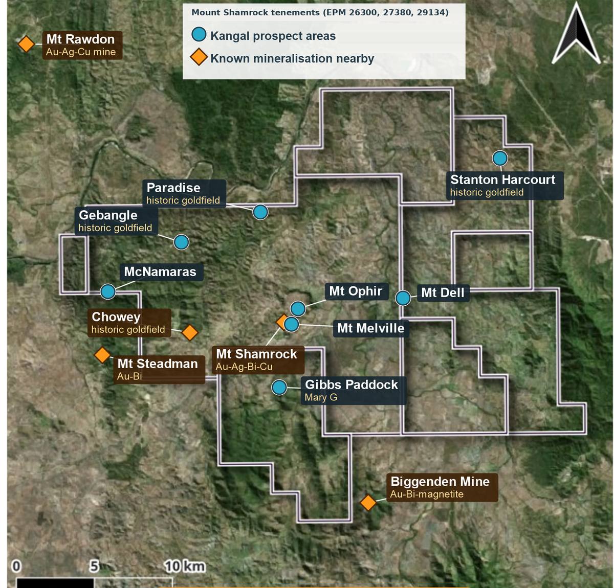
Satellite map of the Mount Shamrock tenement package showing Kangal prospect areas and nearby known mineralisation

Mount Shamrock tenements (EPM 26300, 27380, 29134). Blue markers: Kangal prospect areas. Orange markers: known mineralisation nearby.

The Mount Shamrock tenements straddle a belt where Permian volcaniclastic and shallow-marine sequences are intruded by Triassic granites and intermediate porphyries. That combination has produced skarns, intrusion-related gold systems and vein-hosted goldfields across the district — several of which were worked historically and then largely left alone.

Much of the ground has never been drilled. Where drilling exists, it is decades old and tested surface geochemistry rather than the geophysical targets now available. Kangal has completed ground magnetics, gravity and both gradient-array and pole–dipole IP across the priority areas, and has reprocessed the open-file data left behind by previous explorers.

Known mineralisation nearby

Mt RawdonAu–Ag–Cu mine, north-west of the package
Mt SteadmanAu–Bi
Mt ShamrockAu–Ag–Bi–Cu
BiggendenAu–Bi–magnetite mine, to the south-east
Coalstoun LakesCu–Au–Mo porphyry, south of the package

Prospects

Six target areas, at three stages of maturity.

Each prospect is labelled by how far it has been advanced — from drill-ready concepts with defined chargeability targets, through untested historic goldfields, to brownfields ground carrying substantial past drilling.

Mt Dell

Drill-ready

Skarn – porphyry

Kilometre-scale metal zonation defines a compelling Cu–Au target with a hotter W–Mo core.

  • Permian shallow-marine and mafic volcaniclastic host sequence, with intermediate porphyry intrusives nearby.
  • Cu–Au mineralisation with garnet–chlorite–epidote–magnetite skarn alteration, coincident with gravity and magnetic highs and well-defined ESE- and NNW-trending structures.
  • 136 multielement rock-chip analyses define Pb–Zn peripheral zoning around two Cu–Au target zones.
  • Still untested by drilling. Proposed scout program: five diamond holes for about 1,000 m — two into each chargeability target, one conditional on early results — aimed at 50–70 m depth to test for supergene enrichment.
5,350 ppmCu, grab sample
0.39 g/tAu, grab sample
136Rock chips
~1,000 mProposed drilling
Gibbs Paddock

Coincident IP target

Intrusion-related gold

A granite-hosted gold system mapped directly above a coincident IP chargeability and resistivity high.

  • Degilbo Granodiorite (Triassic) intruded by at least four hydrothermal veins; the main gold cluster sits at the contact with Gympie Group volcanics.
  • Iron-staining and sericite alteration of the granite observed over a large area.
  • The 15 best rock chips grade 1.3–8.0 g/t Au, with Ag to 485 g/t, Cu to 2.05%, Pb to 3.4% and As to about 11%.
  • Au–Bi–Te–As–Sb is the classic intrusion-related association: across 32 chips, log Au correlates with As (r = 0.93), Bi (0.81) and Sb (0.78).
  • Chips above 1 g/t Au (n = 14) carry median Bi of 278 ppm and Sb of 1,108 ppm, against 4 and 23 ppm in chips below 0.1 g/t Au.
8.03 g/tBest Au chip
485 g/tBest Ag
0.84%Best Sb
0.53%Best Bi

Stanton Harcourt

Untested by drilling

Historic goldfield

A hardrock and alluvial goldfield with copper–gold rock chips sitting over a substantial magnetic structure.

  • Little modern exploration, and no drilling. Mineralisation is associated with microdiorite dykes and quartz–carbonate veins adjacent to propylitically altered intermediate dykes.
  • Mt Busteed workings lie on the edge of a regional gravity high, beside a gravity low interpreted as an intrusive. Rock chips there returned up to 1.75% Cu and 1.18 g/t Au in altered mafic rocks, with a semi-float chip 370 m to the north-north-west at 1.72 g/t Au.
  • A roadside cutting 2.7 km west-north-west carries chrysocolla in mafic rock — six of eight samples above 1,000 ppm Cu, to 1.14% Cu.
  • Three pole–dipole IP lines cover the workings; the strongest chargeability response lies directly beneath them.
  • A historic gold-in-soil anomaly of roughly 600 m by 500 m still needs digitising.
1.75%Best Cu chip
1.18 g/tBest Au chip
~2.4 kmRTP magnetic feature

Chowey

Stand-up drill target

Vein gold – breccia

High-grade vein gold and an adjacent breccia sit on a strong chargeability high.

  • Five rock chips from the Chowey mine veins grade 7.5–20.2 g/t Au, with Bi to 93 ppm and Te to 22 ppm.
  • An iron-stained quartz breccia about 200 m to the west is anomalous in arsenic (to 472 ppm) and antimony (to 19 ppm).
  • Gradient-array IP shows a chargeability high over both the breccia and the mine veins.
  • A pole–dipole line crossing both shows a strong response within about 55 m of surface, peaking under the breccia and continuing beneath the mine.
  • Molybdenum to 507 ppm with molybdenite veins — the district's strongest Mo signature.
20.2 g/tBest Au chip
507 ppmBest Mo
<55 mTarget depth

McNamaras

Trend definition

Mt Steadman – Gebangle

Gold-bearing quartz–dolerite breccias and coincident magnetic highs define a mineralised trend running toward Gebangle.

  • Gold occurs in white chalcedonic quartz forming a breccia matrix with strongly sericite–chlorite altered dolerite clasts.
  • Mineralisation continues about 5 km north-east toward Gebangle, supported by multiple rock samples above 0.5 g/t Au.
  • Coincident silicified “cherty” horizons extend for kilometres to the north.
  • Breccias correlate strongly with ground-magnetic highs, giving a practical and cheap exploration vector along the trend.
  • An Au–Bi–Te association supports an intrusion-related gold interpretation.
~5 kmTrend to Gebangle
>0.5 g/tAu, multiple samples
Au–Bi–TeElement association

Brownfields

Past drilling

Four areas

Four brownfields areas carry substantial past work by Kangal and previous explorers; further exploration could confirm drill targets.

GebangleHistoric goldfield

Drilled by Esso (1974), Haoma (1982), Metana (1988), Placer (1996) and Equigold (2000) — 48 holes for about 3,400 m, with intercepts such as 3 m at 24.8 g/t Au (Metana) and 2 m at 3.7 g/t Au (Equigold). Kangal has since completed 85 line-km of ground magnetics, reprocessed the old Haoma IP data, run one pole–dipole line and taken 40 rock chips, 13 of them above 0.5 g/t Au (best 6.6 g/t at the Lord Nelson pits).

Mt OphirIntrusive centre

The centre of the main Didcot intrusive phase: a rhyodacite porphyry stock with ring fractures and brecciated rhyolite dykes. Drilled by BP Seltrust (1983, 11 holes), Placer (1996, 7 RC holes) and Equigold (2008–09, 4 holes); best result 4 m at 5.4 g/t Au from 76 m (Placer). Evolution added soils, ground magnetics and gradient IP nearby in 2010–13. No Kangal rock chips taken here yet.

Mt MelvilleShamrock corridor

Only two shallow Placer RC holes (98 m, 1996), with no significant intercepts. It lies about 0.4 km south of Equigold's Mt Shamrock diamond hole MSDD004, which cut 2 m at 9.92 g/t Au from 454 m in 2009.

ParadiseHistoric goldfield

A historic goldfield with no drillholes in the compiled database. Equigold-era soil sampling has been compiled and Kangal's regional gravity survey now covers the area.

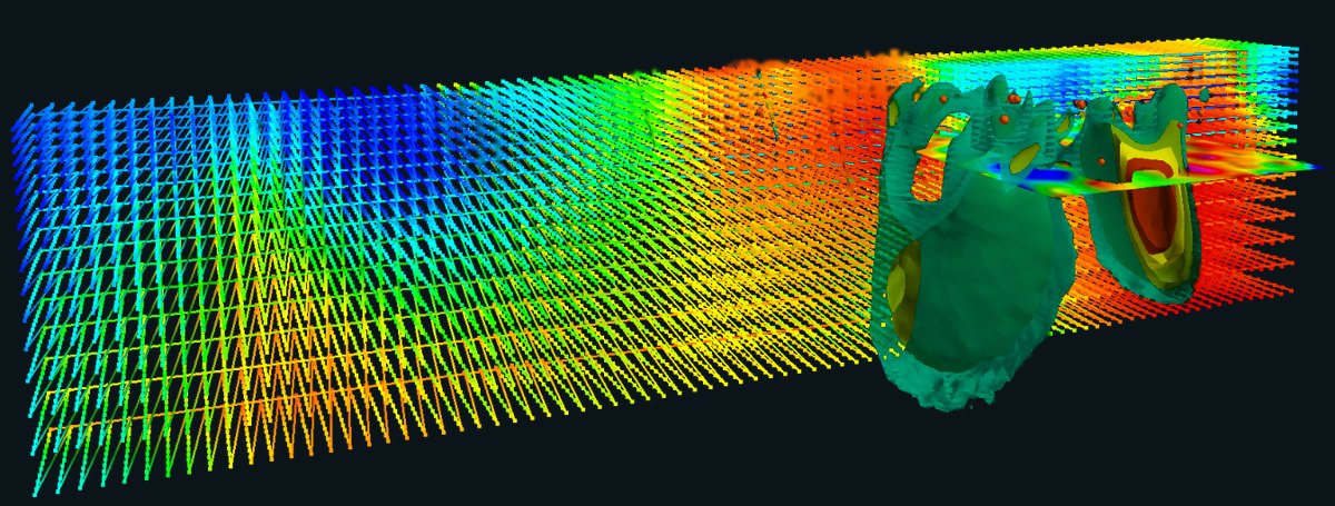
3D geophysical inversion

Results

Ten best gold rock chips, Gibbs Paddock

From the 2026 program at the Mary G vein system, where 32 chips were collected. Antimony and bismuth track gold closely through the system — the signature of an intrusion-related source at depth.

Ten best gold rock chips from the 2026 Gibbs Paddock program
Sample Description Au g/t Ag g/t Cu ppm Pb ppm As ppm Sb ppm Bi ppm
RC2630Western pit gossan8.0360.33699,26077,900400888
RC2618Vein north of Mary G7.7464.66051,145111,000784130
RC2628Vein 2 pit6.7453.68281,160105,500710149
RC2622Mustard granite6.1138520711,25083,0001,3355,260
RC2619New vein, west4.846.97452,27047,800880176
RC2620New vein, east4.294.71271,50068,50027865
RC2621Vein 2, west4.111821,89034,20029,6006,8101,475
RC2627Vein 3 gossan4.104853,97015,650111,5008,4304,340
RC2625Vein 3 quartz vein3.2226420,5007,42088,8002,4402,700
RC2629Vein 2 pit, re-chip2.1722.738775652,80045344

Highlighted values are the highest in each column. Au and Ag in g/t; all other elements in ppm. Rock-chip and grab samples are selective by nature and are not necessarily representative of the mineralisation sampled.


In the field

Boots on the ground

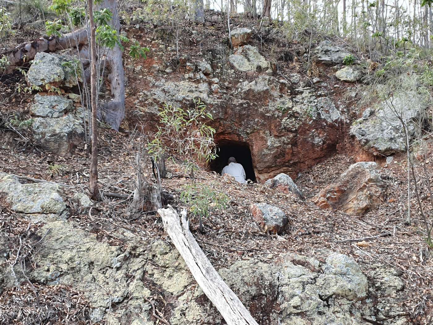
A geologist at the mouth of a historic adit cut into an iron-stained rock face
Historic adit in iron-stained ground. Much of the district was worked by hand and then left untouched for a century.
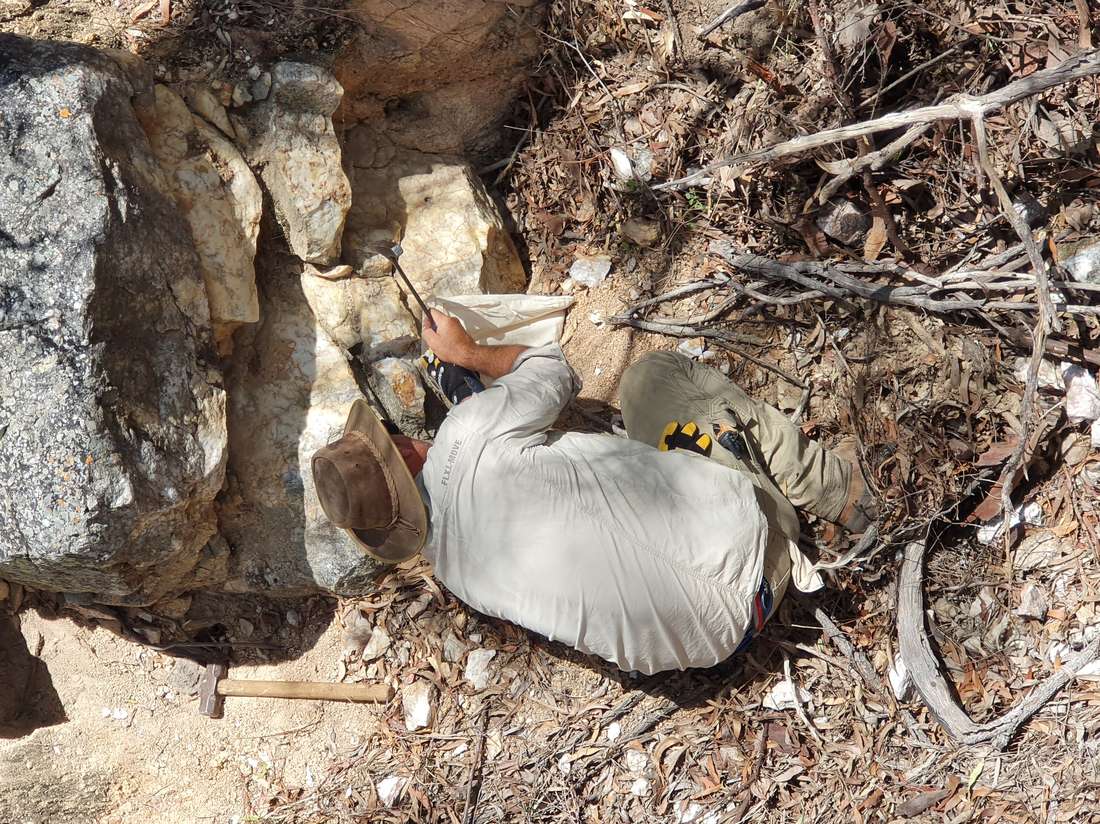
A geologist chipping a sample from a quartz vein outcrop with hammer and chisel
Chipping a quartz vein. Every result on this page began as a hammer, a chisel and a calico bag.
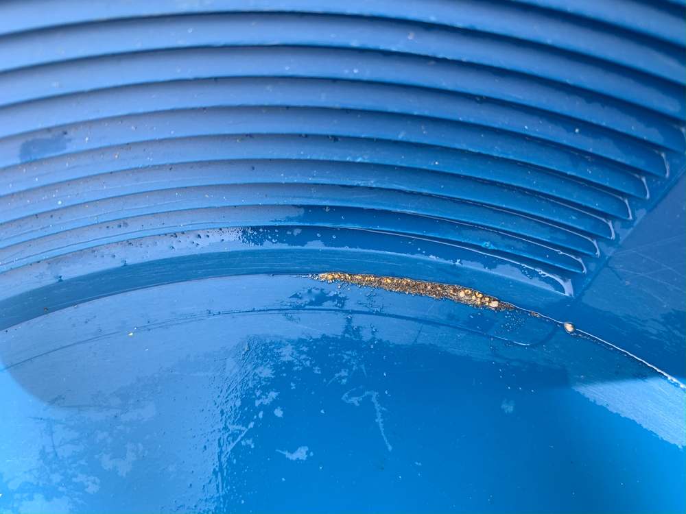
Gold colours and heavy mineral concentrate in the riffles of a blue gold pan
Heavy-mineral concentrate in the pan — the first-pass check that a drainage is worth following up.

Contact

Enquiries

Kangal Resources Pty Ltd welcomes enquiries from investors, joint-venture partners and landholders. Technical data rooms and the full Mount Shamrock presentation are available on request.

Company
Kangal Resources Pty Ltd
Registered office
100 Neil Street
Toowoomba QLD 4350
Australia
Tenements
EPM 26300   EPM 27380   EPM 29134

Important information

The exploration results described on this page are early-stage. They comprise rock-chip and grab samples, soil geochemistry and geophysical surveys, together with historic drilling results sourced from Queensland open-file company reports. Rock-chip and grab samples are selective by nature and are not necessarily representative of the grade or continuity of the mineralisation sampled. No Mineral Resource or Ore Reserve has been estimated for any part of the Mount Shamrock Project, and there is no certainty that further exploration will result in one.

Historic drilling results reported here were generated by previous explorers and have not been independently verified by Kangal Resources. Proposed drilling programs are subject to funding, access and statutory approvals.

Kangal Resources © 2026 Kangal Resources Pty Ltd  ·  North Burnett, Queensland, Australia